Mt Hanang has been a protected area in one form or another for generations but it was only in recent years that it attained a Nature Forest Reserve status.
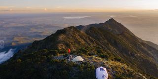
Mount Hanang is a volcanic mountain located in Hanang district, Manyara region
Rising to an elevation of 3,420 metres above sea level, it is the fourth highest mountain in Tanzania after Mt Kilimanjaro, Mt Meru and Loolmalasin peak in the Ngorongoro highlands.
Mt Hanang, which is located in the Great Rift Valley, some 250 kilometres from Arusha, is a dormant volcano. Dormant volcanoes are the volcanoes that are 'quiet' but might erupt again in the future. If a volcano has been 'silent' for years erupts again or shows activity, it is called a 'dormant volcano'.
Mt Hanang has been a protected area in one form or another for generations but it was only in recent years that it attained a Nature Forest Reserve status. Its forest reserve has an area of 58.66 square kilometre area, protecting an enclave of evergreen montane forest on the mountain's higher slopes.
The towering mountain in the generally semi-arid landscape in Hanang district and the surrounding districts and regions has been a key source of fresh water for people and livestock found on its slopes.
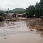
Water is obtained through a number of streams originating from the evergreen forests. Among the main streams are Himiti and Gendabi which were flooded yesterday causing havoc to residents of Katesh and Gendabi respectively.
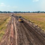
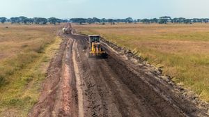
In recent years, the mountain has been promoted for tourism, especially for the mountain climbers, with the principal path to its summit being Katesh town which bore the brunt of the deadly floods early yesterday which killed at least 20 people and injured scores of others.